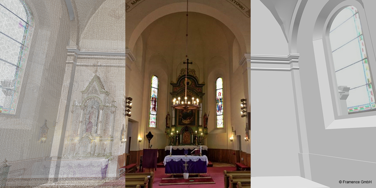
In order to capture or rather digitalize the portfolio, a process also known as reality capture, there are two technological approaches available on the market:
- Methods based on laser measurement and laser scanning.
- Photogrammetric methods using only images.
Currently, many manufacturers and service providers consider these two approaches to be interchangeable, while each believe that the technology they use fits their needs best.
However, we take a slightly more differentiated view, as we know from experience that different applications require different approaches.
When altering or expanding existing buildings or facilities, there is no way around good, precise plans or models. To create these plans and models, the necessary dimensions must be recorded in the real world and then modelled and drawn with the help of appropriate CAD planning tools. Laser measurement is the method of choice for recording the necessary dimensions, lengths or individual points. Whether individual laser measurement points are sufficient or entire point clouds have to be generated depends on the individual case.
For the documentation of complex environments, photogrammetric methods are preferable. This is because they have a much higher level of detail than laser-measured point clouds due to the use of images and are easier and, most importantly, cheaper to realize. Thus, recording the real world repeatedly, especially after alterations, is also economically feasible. Full-frame cameras, simple dual-lens cameras or even drones are used, depending on the environment, the required level of detail and the demands regarding accuracy.
These different application cases lead to the creation of images, point clouds, CAD models and plans at different points in time over the life cycle of buildings and facilities, which could previously only be processed in their usually proprietary software.
FRAMENCE ends this dependency on different technologies and display systems. The FRAMENCE platform combines all this different information and all these different formats in a closed environment. It is important to note that FRAMENCE integrates the different data into a joint, global coordinate system. This allows our clients to reuse all existing data and visualize it in a central, open platform.
Furthermore, all functions available in FRAMENCE, such as points-of-information, linking with external data and blending of the different models, can also be used.
It is important that all data is available in its temporal context, i.e. its period of validity and date of origin. Using a simple time slider, the user can move through time and thus through the history of a building or facility.
Laser data acquisition and photogrammetry form one unit on the FRAMENCE platform. Thus, our unique hybrid approach creates a true single point of data access that is completely independent of any capture technology you may choose.
No matter which technology you use for your individual application case, FRAMENCE ensures that your investments are not lost and that they stay economically valuable in the long run.


